Inspired by Stamen’s infamous map designs, this digital watercolour illustration highlights the City of Guelph and its surrounding regions.
Original artwork by Surface Impression (Aedán Crooke) for the Information Privacy Commissioner of Ontario
City of Guelph
GeoDataHub uses GIS to share just-in-time information on snow plowing, grass maintenance and much more
The City of Guelph’s GeoDataHub offers one-stop access to the city’s data on a variety of topics as well as practical information in real-time, such as where snowplows are, using GIS technology.
The City of Guelph’s GeoDataHub offers one-stop, easy online access to the city’s open datasets on a variety of topics. It uses geographic information system (GIS) technology to display useful information about what is going on around the city.
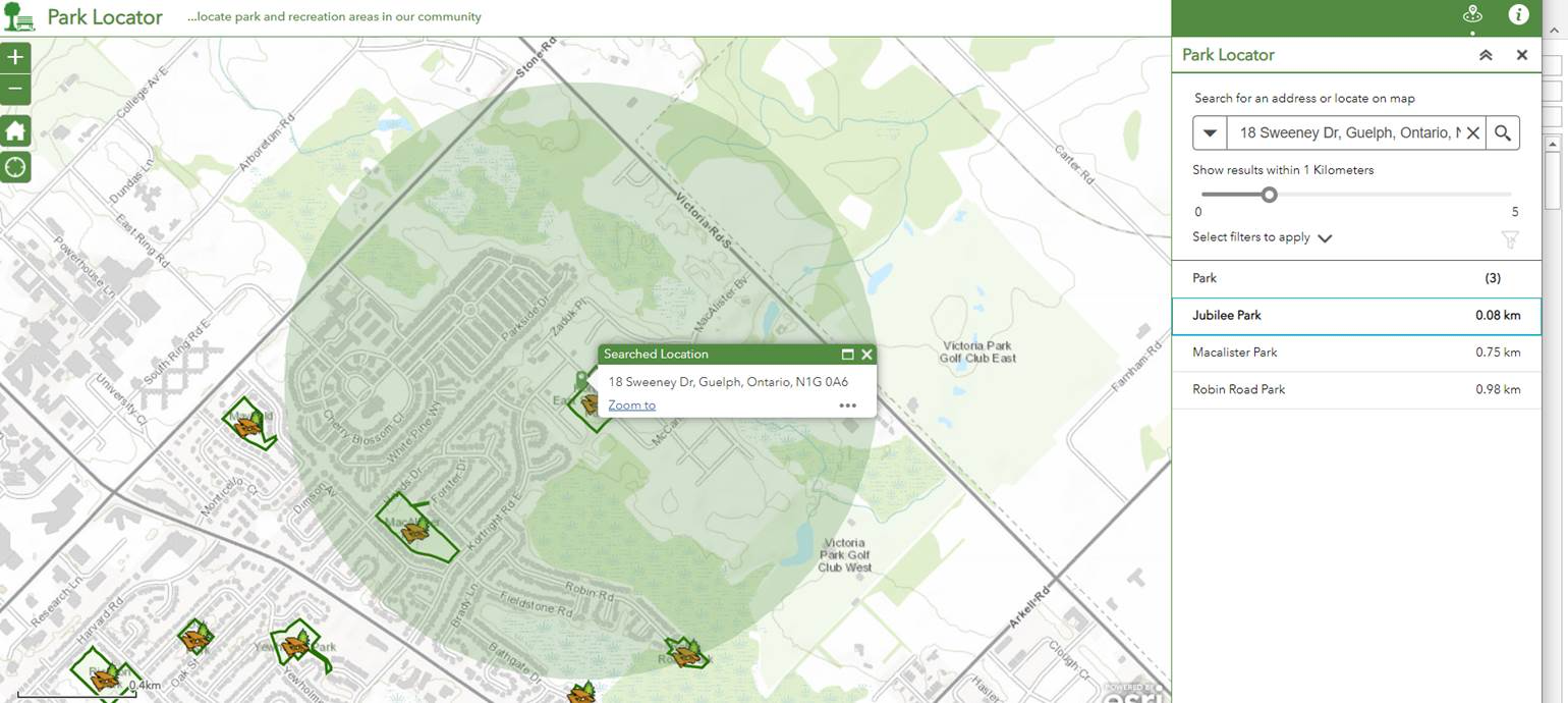
Image provided in English only.
One popular map on the GeoDataHub is the plow-tracker. Residents find it helpful during snowstorms to see when plows are working in their area in real time. Other features include a grass maintenance tracker map which allows the public to see when the grass was last cut in a park. Other maps include a park locator, a zoning map, and a street tree ownership map, which classifies if a tree is considered to be on personal property or if it is the responsibility of the city.
The city has also teamed up with the Guelph Neighbourhood Support coalition to build a map that allows people to add information about events and activities in their community, and they have plans to increase its use as a communications tool to reach residents.
When it was launched in 2018, the GeoDataHub quickly became the go-to place where anyone could search and view Guelph’s datasets related to community gardens, transportation, land use and development, infrastructure, and more. It gives people access to information without having to submit a freedom of information request, allowing them to combine datasets and perform analyses with maps and charts. It also shares insights with the public into the city’s operations and encourages community engagement.